Hotels between Merthyr and Brecon
This page covers hotels between Merthyr Tydfil and Brecon in Wales. First I list hotels just off the A470 road from Merthyr to Brecon (listed from south to north). Then I list a few other [more…]
This page covers hotels between Merthyr Tydfil and Brecon in Wales. First I list hotels just off the A470 road from Merthyr to Brecon (listed from south to north). Then I list a few other [more…]
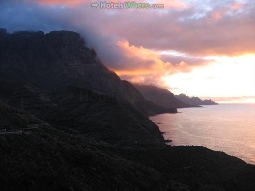
Gran Canaria West Coast Road The west coast of Gran Canaria (the one facing Tenerife) is very rocky and wild. You will not find towns here because there simply is not space for them. Most [more…]
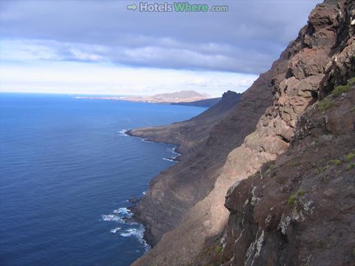
Gran Canaria West Coast The west coast of Gran Canaria between La Aldea de San Nicolas and Agaete is one of the most amazing sceneries you can see in the Canary Islands (and anywhere else). [more…]
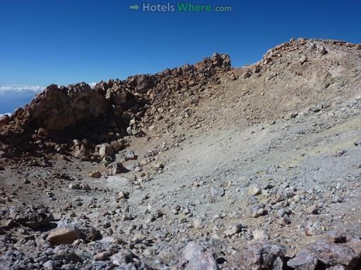
Teide Crater Size and Shape Although Mount Teide is the third largest volcano in the world (by height measured from the foot of the volcano on the seabed), Teide crater is quite small. It has [more…]
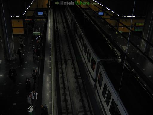
Madrid Metro Network Madrid has probably the highest metro network density in the world. Madrid metro is the sixth longest worldwide (after five much bigger cities: London, New York, Moscow, Seoul, and Shanghai) and the [more…]
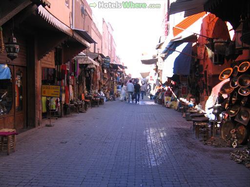
Marrakech Souks A souk (which may also be spelled souq) is a traditional open-air market that you can find in the streets of old towns in Arab or Berber cities. The souk in Marrakech is [more…]
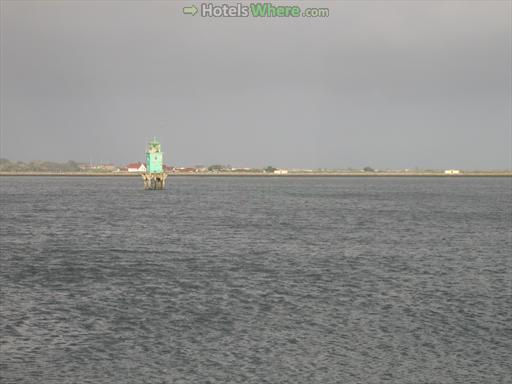
The North Bull Lighthouse is one of the two lighthouses marking the entrance into Dublin Port (the other one is the Poolbeg Lighthouse) and one of the tree lighthouses in Dublin Bay (the third one [more…]
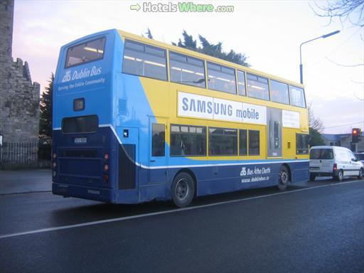
Dublin City Bus Schedules and Official Info Official information, including timetables, route planner, fares, and diversions, can be found on the official website: www.dublinbus.ie Dublin City Bus Picture This is how a typical Dublin city [more…]
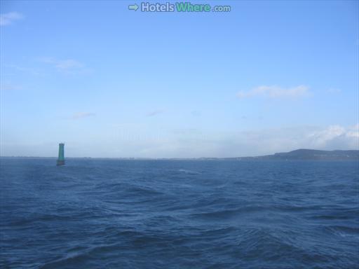
North Bank Lighthouse is one of the three lighthouses near the entrance into Dublin Port in Dublin Bay. It has rectangular shape and green colour. Unlike the other two lighthouses, it stands on several stilts. [more…]
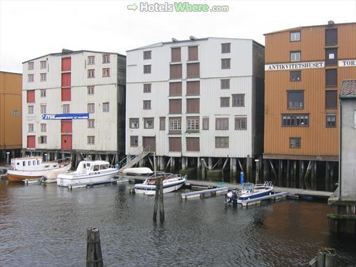
Trondheim – the City of Wooden Houses In the past wood was the primary building material in Trondheim. Many wooden houses were preserved in the city centre and along the water areas: the Nidelva River, [more…]
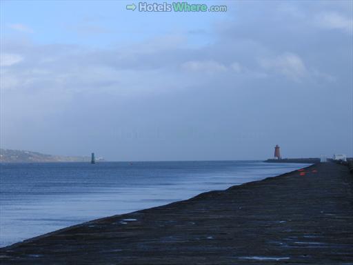
Poolbeg Lighthouse is one of the two lighthouses at the entrance into Dublin Port in Dublin Bay. These are the two lighthouses. Poolbeg Lighthouse is the closer one (on the right). It is located in [more…]
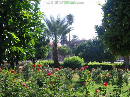
Lalla Hasna Park is located behind the Koutoubia Mosque, just 5 minutes walk from Djemaa El Fna. When compared to the Marrakech medina, it is a different world. You will meet much fewer people here [more…]